By Dinah Voyles Pulver, dinah.pulver@news-jrnl.com
Florida emergency management officials are often quick to make a flip remark when asked about flood insurance.
If you’ve got a Florida driver’s license, they say, chances are you’ll one day be faced with a flood.
“There’s no such thing as a home that doesn’t flood in Florida,” said Larry LaHue, senior planner for Volusia County Emergency Management. “There’s high risk and low risk, but there’s no such thing as no risk.”
Nothing illustrated that risk — or the growing risk from rising sea levels around the state — more than the devastating hurricanes, tropical storms and intense rainfall in 2016 and 2017. Residents and officials alike began to question more seriously just how much worse the flooding could be or how much more often it could flood as seas continue rising.
“I think it was a wake-up call for everybody,” said Brady Smith, director of resilience for the Tampa Bay Regional Planning Council.
Flooding, including sea level rise-related flooding, isn’t a concern just for those who live on the coast.

People are often “very surprised” when Tara McCue, director of planning for the East Central Florida Regional Planning Council, displays future sea level rise maps that show flooding inland. She said people typically think, “Oh, it’s the beachside, the ocean front side.”
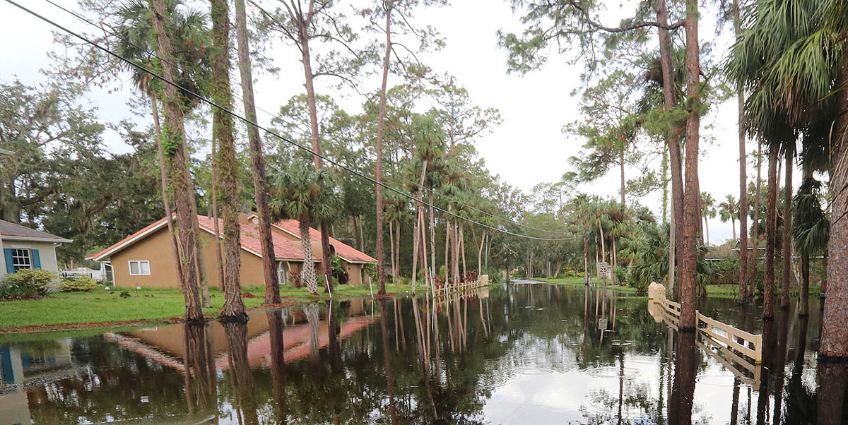
As Hurricane Irma helped illustrate, Floridians who live on or near rivers, streams and canals, or in low-lying areas, could be affected by rising seas, whether they live one mile or 25 miles from the ocean.
Roy and Sandy Walters live in a home overlooking Lake Monroe and the St. Johns River in Enterprise, 28 miles west of the Atlantic Ocean and more than 125 miles south of where the river flows into the sea at Mayport. But after Hurricane Irma in early September 2017, a combination of rainfall, lunar tide cycles and offshore systems kept ocean tides higher than normal in Jacksonville. As a result, yards and streets throughout much of the Walters’ scenic neighborhood to the south were flooded for weeks. The couple was forced to rent a sport utility vehicle to drive through their flooded streets.
The St. Johns River begins in a vast floodplain spread across several counties to the south of Lake Monroe, between Central Florida’s Volusia and Seminole counties. On the north side of the large lake, the northward-flowing river funnels into a narrow channel. “Somehow all of that water has to go out to the ocean,” said Roy Walters, a retired physicist and engineer. “When the sea level comes up, it’s just that much harder to push out and it just takes longer.”
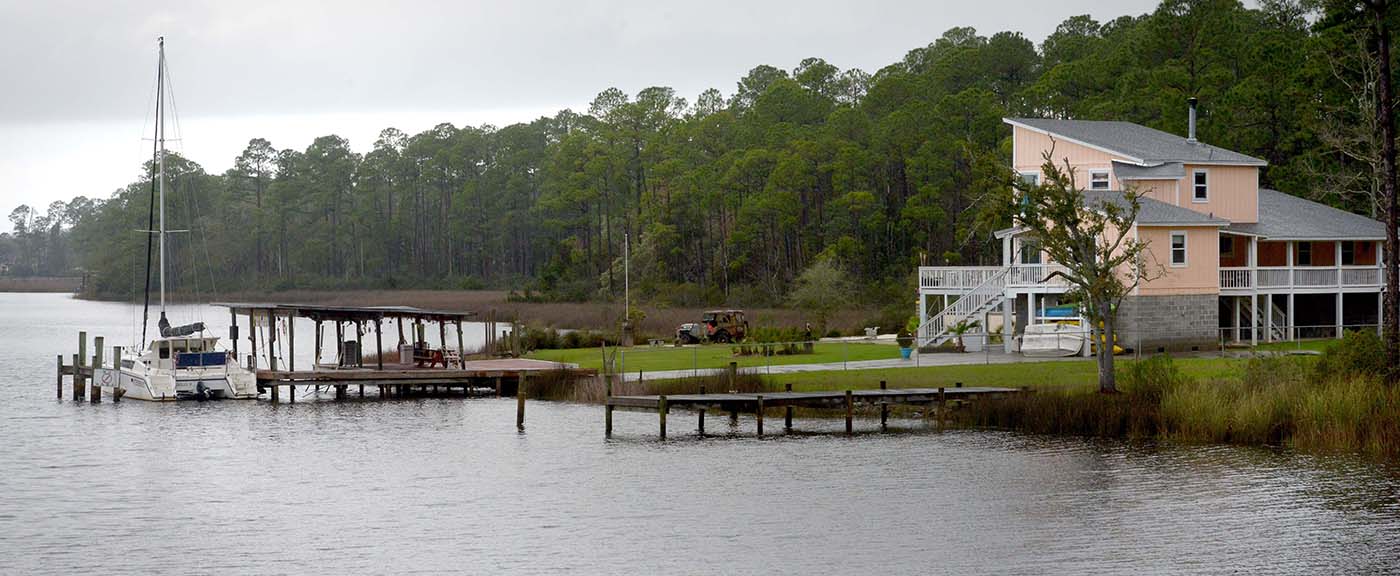
The Walters’ dock was underwater for three months and after four months, the flooding still hadn’t completely receded. Roy Walters thinks the river floods more often and stays flooded longer than it used to. At age 76, he isn’t worried about losing the home to the water in his lifetime. Other homes in the community flooded last fall, but his home has a 12-foot floor elevation. However, he and his neighbors are concerned about repeated flooding on the roads in their waterfront neighborhood.
At the mouth of the St. Johns River near Jacksonville, tide gauge records show the Atlantic Ocean has risen about a third of an inch per year — a total of more than 3 inches — over the past 10 years at Mayport, according to the National Oceanic and Atmospheric Administration.
Mid-range projections from NOAA indicate seas could rise 5.5 to 12.6 inches in Florida within 12 years. By 2050 — almost within the window of a 30-year mortgage — seas could rise anywhere from 9.5 to 23.64 inches. More extreme NOAA scenarios put the sea level up to 38 inches higher in Florida by 2050.
Rising flood risk
The state’s newly updated hazard mitigation plan spells out the risk for the low-lying state: “The entire state of Florida is particularly susceptible to flooding due to the large amounts of coastline, significant drainage systems and the relatively low elevations.”
Of Florida’s 67 counties, 49 are considered at high risk of flooding. The plan’s 500-year floodplain map nearly blankets the state. That’s not including sea level rise. And it doesn’t take into account the heavier and longer lasting rainfall events forecast to occur in the future.
Since 1970, some portion of the state has seen a flood-related federal disaster declaration 29 times. Between 2012 and 2016, 227 flooding events were reported in the state, an average of 45 a year, according to the Florida Division of Emergency Management. That includes an annual average of nearly 10 coastal flood events and 16 life-threatening floods, with annual property loss averaging $86 million, the department reports in its hazard mitigation plan. Since 1978, the National Flood Insurance Program has paid $4.1 billion in 255,725 claims in Florida.
Officials across Florida have yet to get a firm grip on what rising sea levels could mean for the state’s future flooding woes.
Isolating the factors that contribute to flooding is complex. It’s almost always a combination of things, such as extraordinary rainfall, storms, hurricanes, seasonal high tides and inadequate, older or improperly built drainage systems.
Perhaps nowhere in Florida is epic flooding — the likes of Harvey in Texas in 2017 — more of a threat than Tampa Bay, where a massive hurricane could send a 30-foot storm surge into the region, depending on the direction and timing of the storm.
“Over 30 feet is unimaginable, but it’s plausible,” said Smith. The amount of water that could be potentially pushed up through the Hillsborough River, the Anclote River and the Little Manatee River could mean “tremendous flooding in places that are far inland because of the storm surge pushing up the river basin.”
So far, the region has been fortunate, he said, with only one major hurricane since 1921.
The region is just beginning to question how a hurricane’s impacts might be affected by a 2-to-3 foot rise in sea levels, said Smith. “We’re just starting to see some of those efforts in our region to look at the potential of a situation when you have the additive effects of intense rainfall, sea level rise and storm surge.”
Storm surge flooding was the worst on record in parts of Jacksonville after Hurricane Irma. Jacksonville’s electrical utility estimated more than 10,000 of its customers were flooded in Irma’s aftermath.
St. Johns Riverkeeper Lisa Rinaman and others fear flooding will grow worse.
Rivers along Florida coasts long have been affected by high tides. The St. Johns — which drops only 30 feet from its headwaters in Indian River County to its mouth at Mayport, about an inch a mile — experiences tidal effects as far south as Lake Harney, said Peter Sucsy, a technical program manager for the St. Johns River Water Management District’s bureau of hydrodynamic modeling. Daily tide effects are felt as far south as Astor, in north Lake County just west of the Volusia County line. High tide events such as lunar high tides and king tides are felt as far as 230 miles south along the river.
On the Gulf side of the state, the Suwannee River is tidally influenced as far inland as Fanning Springs, about 31 miles along the river to the north.
The more the Atlantic Ocean and Gulf of Mexico rise, the farther inland the impact of saltwater could be felt, although the river levels won’t correspond directly because water spreads out as it moves inland.
On Florida’s west coast, residents and scientists already see evidence the Gulf of Mexico is pushing saltier water farther upstream in the Withlacoochee River. The encroachment of saltwater is a concern because it can disrupt freshwater ecosystems when saltwater species move in and create conditions that cause freshwater species, such as palm trees and cypress trees, to die.

Dan Hilliard owns a place along the Withlacoochee and has watched as barnacles appear on dock pilings farther and farther upstream. Cypress trees have died along the river, said Hilliard, president of Withlacoochee Aquatic Restoration, or W.A.R., a group of residents working on the restoration of the lower Withlacoochee River.
But just which impacts are from rising seas and which are from reduced water flow to the river and the long-ago construction of part of the Cross Florida Barge Canal remain open questions, said Hilliard, also president of the Florida Springs Council and the Kings Bay Springs Alliance. W.A.R. was able to successfully fight a proposed mine, Hilliard said, based on the uncertainty about sea level rise.
Folks along the St. Johns River also are watching barnacles move inland, said Quinton White, executive director of Jacksonville University’s Marine Science Research Institute. He reckons they’ve moved upstream at least 20 miles, and “probably even further.”
“It’s very, very hard to tease apart what’s causing those impacts,” said White. “The Army Corps will say it’s water withdrawal and sea level rise.” But others attribute it to dredging and a reduction in fresh water flow.
In Jacksonville, the Riverkeeper sued the U.S. Army Corps of Engineers over its authorization of a project to dredge the river deeper between downtown Jacksonville and the coast, fearing the project will allow another 15 billion gallons of sea water daily to push farther inland.
“Our position is it’s accelerating the impacts of sea level rise,” Rinaman said. “It’s just giving more and more tidal force coming into the St. Johns.”
Just how the rising sea will affect the St. Johns also is a concern in Central Florida. Projections from the East Central Florida planning council show potential impacts stretching as far south along the St. Johns River as State Road 46, between Sanford and Titusville.
After Irma, a portion of State Road 46 east of Sanford was barricaded for weeks in low-lying areas near the river. And that was just from one storm, said McCue. “Now think about the flooding from sea level rise and then you have another one of those storms. That could be the new normal as we go out (State Road) 46.”
Understanding the risk
Storm surge that occurs with tropical storms and hurricanes is the presage for future sea level rise, said Jim Beever, principal planner for the Southwest Florida Regional Planning Council. The council is examining how the various factors combine to cause flooding more often. In his region, the greatest impacts from sea level rise are expected in low-lying areas along the coast, but they won’t be immune from the inland effects.
“When you have a tropical storm of large strength, you’ve got water coming in from the ocean in storm surge, but also water coming down the watershed from precipitation,” said Beever. “That can give you a synergy that compounds the elevation of flooding.”
The combined effects of a storm and land use and water management decisions compound the flooding across Florida. In Lee County, for example, Beever said water from four watersheds drained toward one river and helped create flooding during and after Hurricane Irma. Governments in the region are now looking to reconnect watersheds the way they were naturally, he said, in hopes of mitigating future flooding.
Forecasts for more intense rain in shorter periods of time during the rainy seasons also present a concern, said Beever. As an example, he pointed to the extreme flooding in Texas during Harvey, where one location received 60.5 inches of rain over six days, according to the National Hurricane Center. Flooding also may occur from increases in the groundwater levels related to rising sea levels.
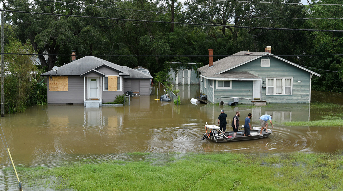
Several communities he examined after Irma had modern stormwater management systems but the pipes that should have been sending water out of the system were submerged because the water in the receiving end was higher than the outfall. Similar events are occurring in tidally connected streams all along Florida’s coasts.
While some cities and counties in South Florida are forced by circumstances like those to address sea level rise flooding, officials elsewhere in Florida are just beginning to consider the implications of future flooding and storm surge impacts.

“We are not as far along as the counties in South Florida, where they’re already flooding,” said the Tampa Bay planning council’s Smith. “They may be the leaders, but they’re also the most vulnerable.”
“Why wouldn’t we want to be prepared for something like this, even if it’s decades down the road?” said Smith. “Why wouldn’t we want to be good stewards and protect the people who live here as best we can?”
South Florida governments, he said, have shown the way local governments can work together to adapt to a changing world.
Mitigating hazards
The city of New Smyrna Beach in Volusia County is the first city to begin taking a serious look after Hurricane Irma flooded homes in the city, not from the ocean side but from the river side. As Irma’s eye pushed north far to the west, the massive hurricane swept a pulse of water through Ponce Inlet into the Indian River, part of the Atlantic Intracoastal Waterway. As a result, Mayor Jim Hathaway said 60 homes flooded along Callalisa Creek, homes that had never seen flooding before.
City officials were shocked into considering for the first time how much worse the flooding could be once seas rise another six or 12 inches.
It doesn’t take a hurricane event, a nor’easter or even a king tide to cause flooding in New Smyrna anymore, said City Manager Pam Brangaccio. “We seem to be getting it more often.”
The city likely will be forced to cope with tough challenges, said Hathaway and Brangaccio, including looking at whether zoning and land use changes are needed to curtail building in areas likely to flood and whether houses in peril should be elevated or demolished.
“I’ve lived in New Smyrna Beach 65 years,” Mayor Hathaway said, “and I’m telling you, until Irma, I’ve never witnessed that kind of flooding.”
At the same time, New Smyrna Beach has thousands of new homes under construction miles from the beach. At a town hall meeting to talk about flooding and sea level rise and other issues in February, more than 250 city residents listened intently as speakers explained the outlook for rising sea levels. Several residents questioned whether the city’s rapid growth was the wisest course, given the forecast for future flooding.
Like some other cities and counties in Florida, New Smyrna Beach may look to grants for hazard mitigation and repetitive flood loss from the Federal Emergency Management Agency to try to address flood-related problems. For example, the city is working with homeowners on a plan to seek grants to elevate some of the homes that flooded during Irma. A city consultant, David Hamstra with Pegasus Engineering, said the cost for elevating a home ranges from $250,000 to $400,000, depending on the size of the home and how high it’s lifted. A FEMA grant could pay up to 75 percent of the cost.
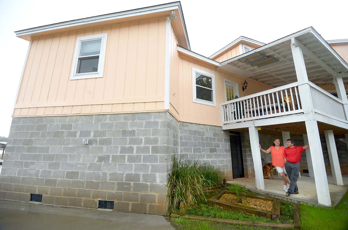
Hamstra is also working with Santa Rosa County in the Panhandle. In Milton, Del and Penny Crawford were flooded with 12 feet of water two weeks after buying their home along a bayou off Escambia Bay in 2004, when Hurricane Ivan struck the Panhandle.
The next season they were flooded first by Hurricane Dennis, then by Hurricane Katrina. Afterward they opened their home to refugees. Today, the Crawfords don’t have to worry as much about flooding from hurricanes or sea level rise. With help from Santa Rosa County in 2015 they took advantage of the FEMA grant program and elevated their home nine feet.
Del Crawford recommended the FEMA program. “It’s either that or keep doing flood damage,” he said.
Santa Rosa County has a lot of flooding issues, said Sheila Fitzgerald, Grants & Special Programs Director.
“We’ve grown a significant amount in the last 10 or 20 years and a lot of our subdivisions were built before the adoption of appropriate stormwater facilities,” she said. “As more homes are built and there’s less soil for the water to drain to, a lot of these neighborhoods are getting roads flooded and houses flooded.”
Declared for 11 disasters since 2004, the county is focusing primarily on subdivision drainage. The impact of sea level rise hasn’t been on the front burner.
“I don’t think we’ve really taken a coordinated approach to really evaluating sea level rise,” Fitzgerald said. “In terms of linking that data to decision-making I would say we are probably not there yet.”
But both the state and the federal government are now requiring counties to evaluate the impacts of sea level rise.
The Florida Department of Environmental Protection recently announced an additional grant opportunity for local governments planning resiliency projects. Resiliency is the new code word among state officials when talking about sea level rise.
In February, the federal government announced $7.4 billion in block grants for Hurricane Harvey recovery in Texas. That program, authorized by President Donald Trump, requires local government participants to take into account continued sea level rise.

In Volusia County, as part of his role in emergency management, Larry LaHue has worked with homeowners on FEMA grants to mitigate flood losses for more than a decade. Grants are available to raise homes or to demolish them so a flood-prone lot can be left empty.
The return on investment in the programs is huge, said Pat White, coordinator of the county’s Volusia Prepares program. FEMA estimates “for every dollar you spend doing mitigation, you save $6 in future losses.”
Rich Rhodes and his wife Lisa live along the Tomoka River in Ormond Beach. After repeated flood events in their neighborhood, including 20 inches of rain over five days in May 2009, LaHue helped them secure a FEMA grant to elevate their home 10 feet. The new elevation is set based on a formula that takes into account the home’s base flood elevation and future sea level rise projections.
“We’re set, we’re never moving again,” said Rhodes. “I just may need a different boat to get me up to solid ground.”
Their street floods when the Tomoka River gets high. To Rhodes, it seems like that’s occurring more often, and the water is higher than it used to be.
“I see more water and higher water in the months September through November,” he said. “Every year it seems to be higher. With Irma, it was crazy, it was ridiculous.”

Be the first to comment on "Hurricanes delivered ‘wake-up call’ on inland flooding"